Mai City Dataset
A synthetic dataset generated from a 3D CAD model in urban-like scenarios.
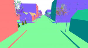
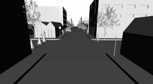
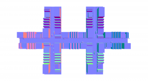
Description
The data was collected by placing virtual sensors on the 3D cad model and, through ray-casting techniques, a LiDAR scan is obtained by sampling the original mesh.
We provide 3 different sequences for now.
- 00: 700 m drive, at 10 m/s in an urban-like environment, data recorded with a virtual Velodyne HDl-64.
- 01: 100 m block of the mai_city_block model, data recorded with a virtual Velodyne HDl-64.
- 02: 100 m block of the mai_city_block model, data recorded with a virtual Velodyne-like LiDAR with 320 beams.
Ground truth poses are provided for all 3 sequences
Related Publication
I. Vizzo, X. Chen, N. Chebrolu, J. Behley, and C. Stachniss, “Poisson Surface Reconstruction for LiDAR Odometry and Mapping,” in Proc. of the IEEE Int. Conf. on Robotics & Automation (ICRA), 2021.
[BibTeX][PDF][Code][Video]
@inproceedings{vizzo2021icra,
author = {I. Vizzo and X. Chen and N. Chebrolu and J. Behley and C. Stachniss},
title = {{Poisson Surface Reconstruction for LiDAR Odometry and Mapping}},
booktitle = icra,
year = 2021,
url = {http://www.ipb.uni-bonn.de/pdfs/vizzo2021icra.pdf},
codeurl = {https://github.com/PRBonn/puma},
videourl = {https://youtu.be/7yWtYWaO5Nk}
}
Files
For simplicity, we use the same directory structure as the KITTI dataset. This way, our dataset can be used out-of-the-box in any application that is working with this KITTI.
We also provide a rosbag file for each sequence, and .ply files for all scans in the dataset
├── bags
├── bin
│   ├── poses
│   └── sequences
│       ├── 00
│       │   └── velodyne
│       ├── 01
│       │   └── velodyne
│       └── 02
│           └── velodyne
├── gt_models
└── ply
    ├── poses
    └── sequences
        ├── 00
        │   └── velodyne
        ├── 01
        │   └── velodyne
        └── 02
            └── velodyne